Scroll for more
Map calculator thumbnail with connected spherical pins for distance and area measurement

Professional Distance Calculator & Map Tool

Maps Distance & Area Calculator is a versatile distance calculator and high-precision mapping platform. It is designed for those who need to measure distance on high-resolution satellite and street layers with absolute accuracy in their spatial data.

Map with Distance Calculator Features

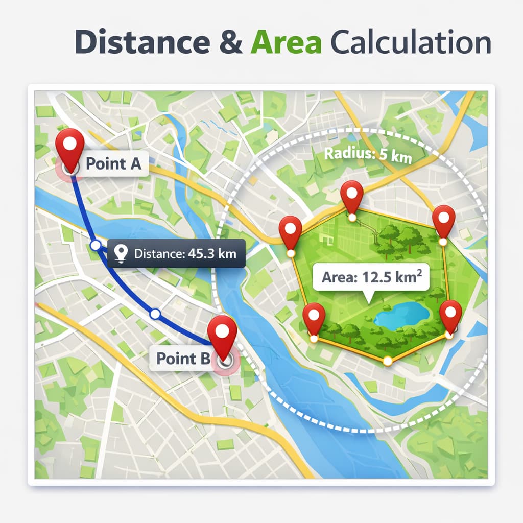
Traditional flat-map projections often distort reality. Our engine utilizes Great Circle distance algorithms based on the WGS84 standard. This ensures that your distance between two points accurate, providing professional-grade results for anyone using our distance calculator map.

High-Resolution Satellite Analysis

Toggle between ultra-high-definition satellite imagery and specialized topographic layers to visualize your terrain with unprecedented clarity. Whether you are identifying property boundaries for real estate or planning complex irrigation systems for a farm, our visual tools let you see the ground as it truly is.

Versatile Use Cases for Every Industry

Agriculture Calculate acreage for seed and fertilizer optimization.
Real Estate Visualize property borders and estimate lot sizes instantly.
Athletics Plan precise running routes for marathon and interval training.
Surveying Preliminary boundary checks and topographic site planning.

Maps Distance & Area Calculator FAQ

What can this map calculator measure?
You can measure distance, area, and perimeter with unit conversion on the same map workflow.

Is this map calculator useful for surveying and field planning?
Yes. It supports planning for surveying, field measurement, and distance analysis tasks.